Flood Retention Structures
Flood Retention Structures in the East Valley of the Phoenix Metropolitan Area
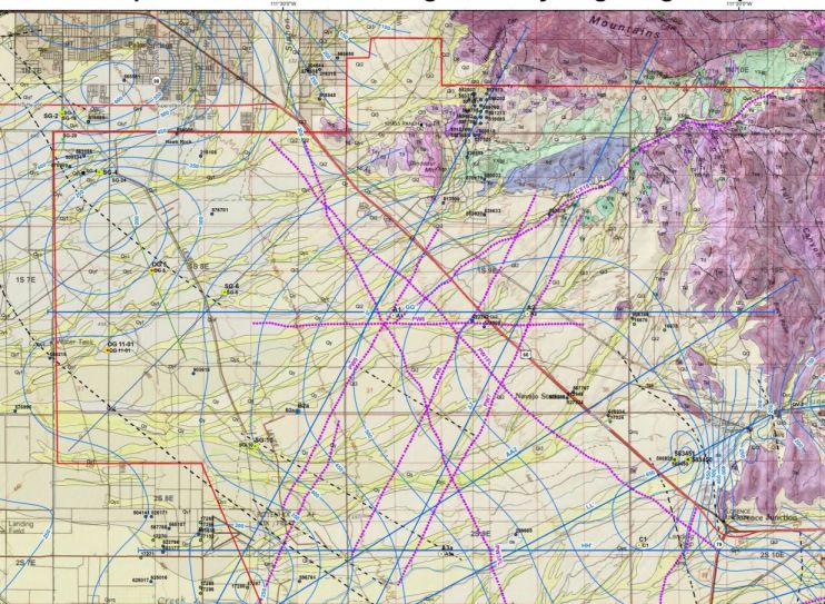
The map below is a hydrogeological map of the region portrayed on this web page. Although it is very detailed and contains an enormous amount of both hydrographic and geologic information, it probably represents the best overview of the geologic circumstances that control the topography of the East Valley area and that, in turn, controls the circumstances of the surface drainage.
The various darker colors along the top and the right side of the map indicate the bedrock of the area, which is uplifted and is resistant to weathering and makes the mountains. The light blue color which dominates the map is the area covered with alluvium -- weathered rock material from the erosion of the bedrock mountains.
The diagrams below are a series of cross sections that show the uncolored bedrock both to the right and at depth, as well as alluvium to the left, which is more deeply colored in these cross-sections. Throughout this entire mapped region, surface streams generally flow from right to left.

The image below is a 1980 (approximately) topographic map of the region tha is made up of four individaul paper sheets that I mosaicked and photographed. The area covered is similar to the above map, but the stream drainage patterns on this mosaic are very conspicuous. Route 60 is the heavy line that runs from the left edge and bends toward the lower right corner. The green arrow is the location of my home in the Superstition foothills, but it shows this location before the area was developed with suburban housing; the black arrow is the location of Silly Mountain; the yellow arrow is the location of the Flatiron near the summit of Superstition Montain; and the red arrow is the location of Hawk Rock, which was present when the map was made. Hawk Rock occurs in the darkened region on the map which emphasizes the area subjected to the development of ground fissures. The maps are part of Open File Report 93-15 by Gary Huckleberry.
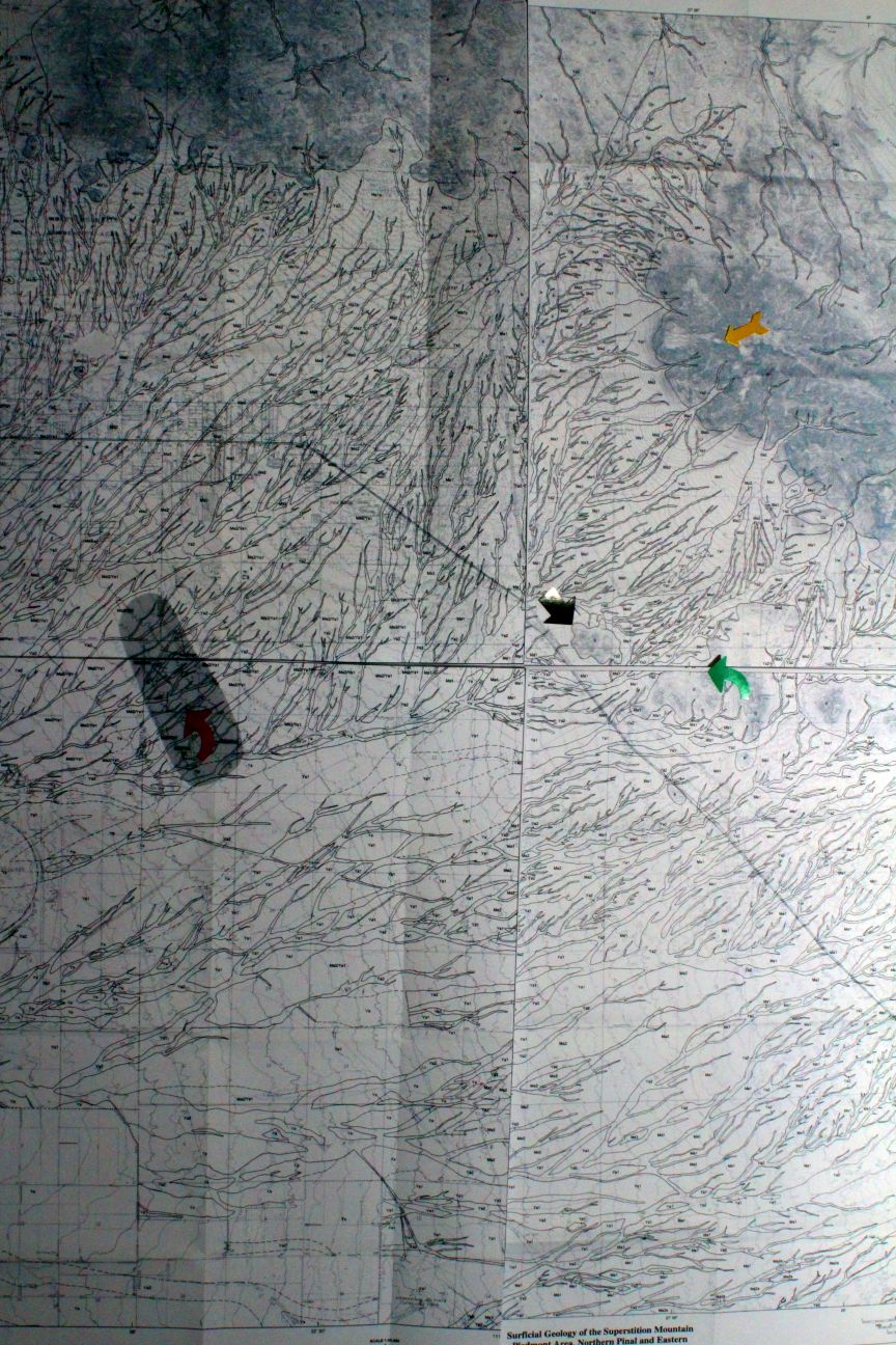
On the above map, notice how the streams flow across the alluvial surface of the valley floor which has a gentle slope toward the west or southwest, but to the casual observer this region looks almost flat. This surface has been favored for commercial and residential development, but it is subjected to infrequent flooding from occasional severe rain storms that occur in the desert climate.
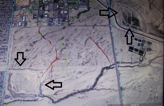
The Google Earth image below shows two flood water retention structures that I visited in November, 2019. These structures typically have no water in them so they can store the maximum amount of water during the times of infrequent flooding.
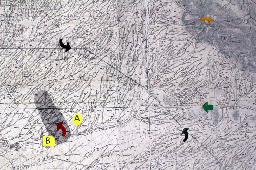
The topographic map below shows these two retention structures as bright yellow features (labeled A and B) relative to the regional drainage pattern. The black arrows indicate route 60, the yellow arrow indicates the Flatiron near the summit of Superstition Mountain, the red arrow indicates the position of Hawk Rock, and the green arrow indicates the location of my home in the Gold Canyon development.
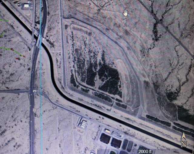
The feature labeled A above, is the "Powerline Flood Retarding Structure," or Powerline RFS, and is shown in greater detail in the Google Earth image below. In the image below, the conspicuous dark linear feature that runs from upper left to lower right is a portion of the CAP (Central Arizona Project) canal, which carries water from the Colorado River to central and southern Arizona.
The images below show the structure as photo mosaics, one taken at ground level and the other from the top of the dam.
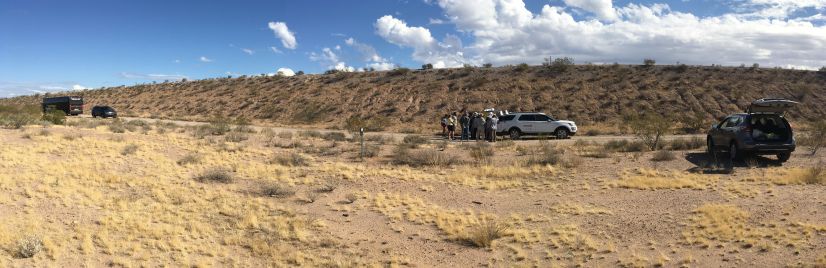
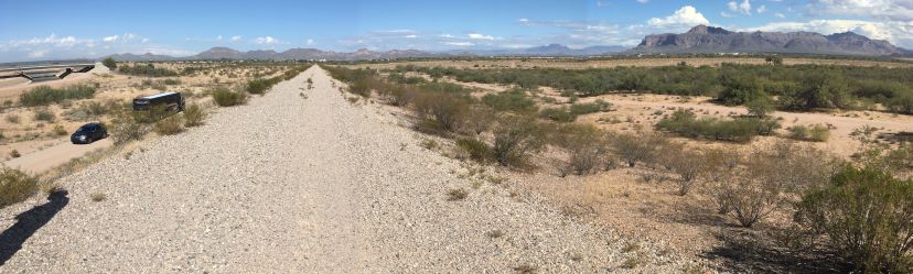
On the above images, notice the bus for scale. The first composite image was taken at ground level and looks toward the east, so the dam is the elevated feature just beyond the road. The second composite image, taken from the top of the dam, looks toward the north, with the empty retarding basin to the right and the Superstition Mountains making the distant horizon.
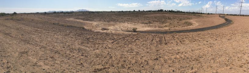
The Google Earth image below shows the Siphon Draw Retention Basin, which was also a site visited on the UNESCO field trip. This is feature B on the bright yellow on the previous regional topographic map of the area.
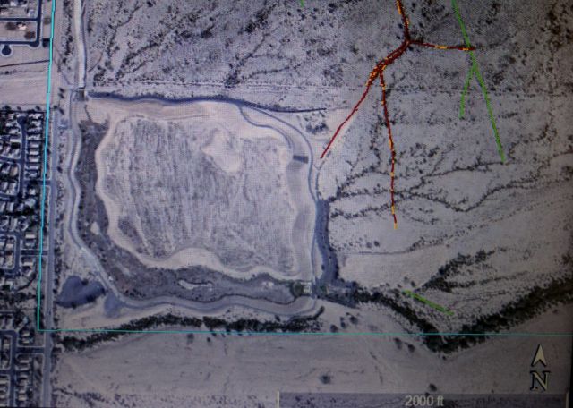
In the image above, notice the close proximity of the housing development (to the left). Notice also the red lines on the image, which indicate identified ground fissures.
The mosaic of images below show this basin as seen from the top of the dam. Like the Powerline FRS basin, this retention basin had no water in it when these images were taken.
References:
Fergason, K., and Rucker, M, Earth Fissures and Infrastructure: A Case History at the Siphon Draw Detention Basin, Central Arizona, in Volume 5-AIEG_AEG_2018, 032,v3 (final): Earth Fissures and Infrastructure: A Case Study.
Field Trip Guidebook for the Final Meeting of the UNESCO-IGCP641 Project, "Land Subsidence and Earth Fissuring in Arizona and the Southwest," November 6, 2019, Tempe AZ. See the following URL: http://www.azaeg.org/wp-content/uploads/2019/09/IGCP-Workshop-Program-1.pdf http://www.azaeg.org/wp-content/uploads/2019/09/IGCP-Workshop-Program-1.pdf
Gootee, B. F., Cook, J. P., Young, J. A., and Pearthree, P. A., 2017, Subsurface hydrogeologic investigation of the Superstition Vistas Planning Area, Maricopa and Pinal Counties, Arizona. Arizona Geological Survey Special Paper 11, 70 p., 2 map plates - 1:60,000 scale, 10 appendices, GIS data.
Hackleberry, Gary, 1994, Surficial Geology of the Apache Junction Area, Northern Pinal and Eastern Maricopa Counties, Arizona, : Arizona Geological Survey, Open File Report 94-10, June, 1994.